
Appearance
Buildings and sites
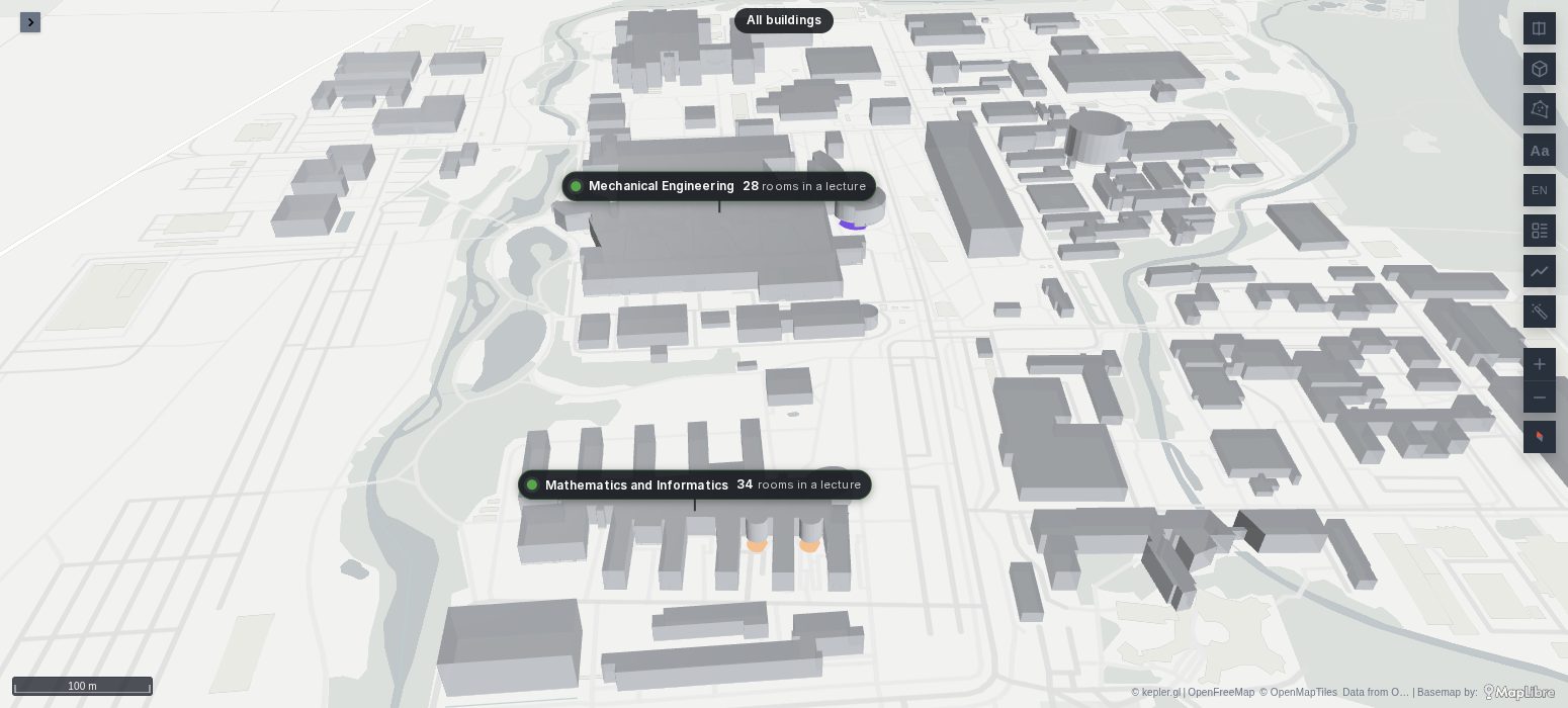
One indoor map can hold a campus, a hospital estate, an airport's terminals or a portfolio of buildings across a country. Floors keeps each building's floors apart, shows the floors of the building you look at, and, zoomed out, stands each building as a card with its figure. A click goes one level in, from the world to a site, a building, its floor and a room, and a breadcrumb over the map goes back out.
Since Plus 1.7.0
Buildings and sites on an indoor map are new in Plus 1.7.0, not released yet.
The map above is the Technical University of Munich's campus in Garching: the rooms of two buildings from OpenStreetMap's indoor tagging, each coloured by whether a lecture is on in it, from the university's room calendar. It is live: TUM Garching through a day of lectures, public and read-only. Zoom in on a building, or pick a lecture in the table beside the map.
A building column
Give the rows a column naming their building: building, building_id, building_name, structure, facility, edificio or bloque, or another chosen in Settings → Data → Building column. Each building then has floors of its own: floor 1 of the library is not floor 1 of the lab.
The building you look at is the one nearest the middle of the view: as you pan to another, the picker lists its floors. It does not flip back and forth between two buildings close together: another building must be clearly nearer before it takes over. The picker's first line chooses the building by hand: Nearest follows the view, a building's name keeps that one.
Settings → Picker → Building variable writes the building looked at to a dashboard variable, and follows it: a dropdown or a link with var-building=Library takes the map there.
Each building its own
A building's name in the Indoor tab opens its window:
- Name: the name the picker, the cards and the breadcrumb show, in place of the column's value (
MIbecomes Mathematics and Informatics). - Base (m): how far its lowest floor stands above the other buildings', for a building up a hill. It is not spread with the floors.
- Default floor: the floor it shows while another building is looked at, and when the map is zoomed out.
While you look at one building, the others show their default floor (Settings → Picker → Other buildings: On their default floor), every floor, or nothing (Hidden). Each building's floors keep their own heights: picking the third floor of one does not lift the other.
Facades
A building's shell, as an extruded footprint from OpenStreetMap or your own outlines, can stand for the buildings you are not inside. Set its query to Building facade: the other buildings, and zoomed out in Settings → Queries: the shells of every building show zoomed out, and those of the others while you look at one; the building you look at shows its floors instead. A facade query needs the building column too, so each shell is known to belong to its building.
Zoomed out
Floors goes indoors at a zoom: 17 by default, a building of a few hundred metres filling a few hundred pixels. Zoomed out past it:
- the picker hides, and every building shows its default floor, or its facade;
- each building stands as a card with its name and its figure over all its floors, and how many rows are amber and red;
- a click on a card flies in to the building, on its default floor.
Settings → Picker → Zoomed out sets the zooms: Indoor from zoom and Outdoor below zoom (half a level lower by default). Two thresholds, so a map resting near one does not flip back and forth. An indoor zoom of 0 keeps the map indoors at every zoom, with no cards.
Sites
With a column naming each building's site (a city, a campus, a region: site, site_name, campus, city, region, sede, ciudad), the buildings of a site close together on the screen gather into one card, the site's, and cards that would overlap gather into one. A click flies one level in: a site to its buildings, a building to its floor. The breadcrumb over the map names where you are, All sites › Quito › Hospital North › Floor 4, and each of its names goes back out to it.
From one building to the next
Indoors, the other buildings keep a small card with their name and figure, so you can go from one to the next without zooming out: those of the site of the building you look at or, with no sites, those within a kilometre, the six nearest. A building in view has its card over it; one out of view is pinned to the edge of the map where the way to it leaves the view, with an arrow. A click on a card flies in to that building, on its default floor, and lets a selection in the building you leave go. Settings → Picker → Their cards indoors → Hidden turns them off.
Floors shown together
Some floors are seen together: a mezzanine with its hall, the galleries round an atrium. In a floor's window, on Floor, Shown with it lists the other floors of its building: those ticked show with it whenever it is picked.
Go to a room or a sensor
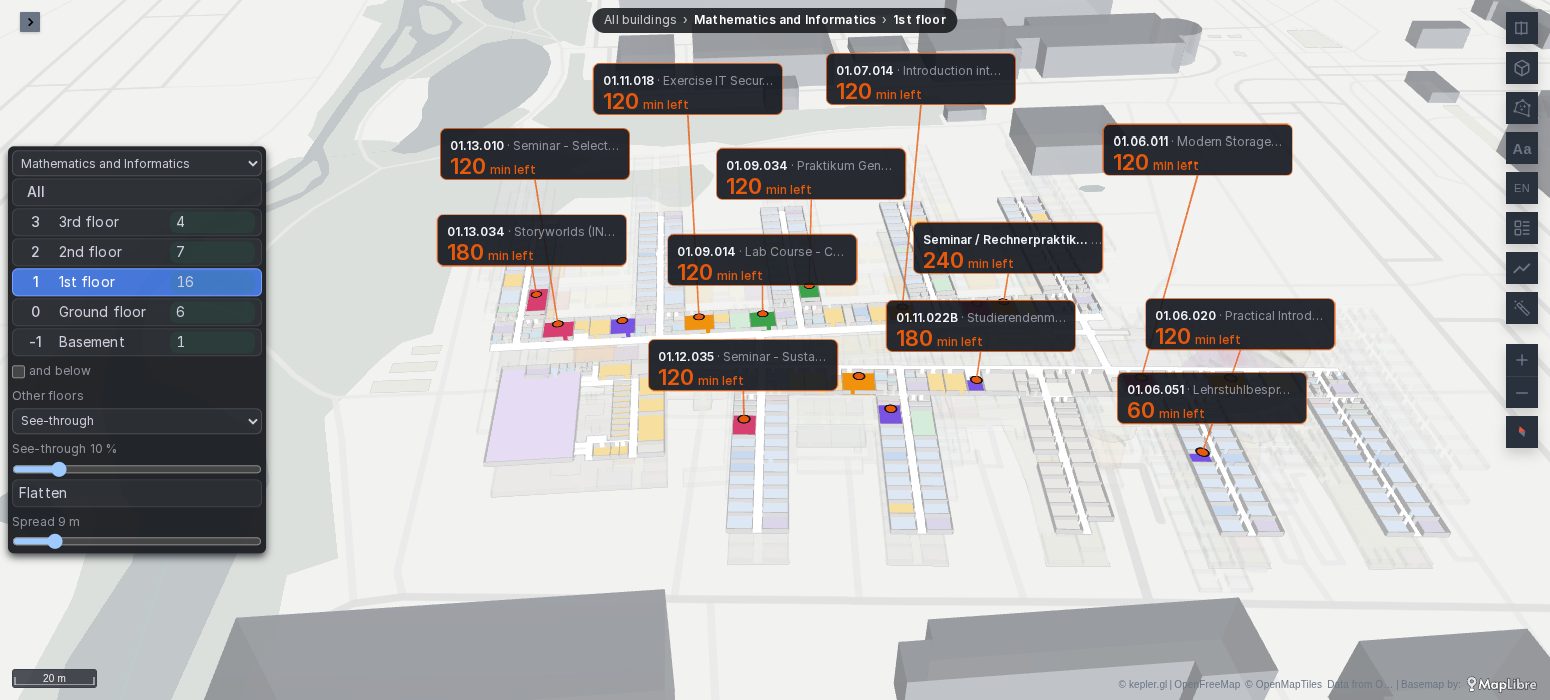
A Selection variable names one thing on the map, on whichever building and floor it is: a room, a sensor, a machine. Set from outside (a link, the URL, a table's data link, another panel), the map goes to its building and floor, flies to it and rings it, and the breadcrumb ends with its name and a ×, which lets it go.
In Settings → Picker:
- Selection variable: the variable's name, such as
room. - Matched by: the column the variable's value is looked up in; by default the first of
code,id,room,room_name,sensor,sensor_id,assetornamethe rows have.
A table of rooms whose names link to the same dashboard with var-room=${__data.fields.room} turns the table into a finder: a click on a row takes the map to that room. A value of the form @latitude,longitude (with ,zoom after it if you like) goes to a place instead, for a point that is no row of the map.
The selection is a variable like the floor, so the other panels can follow it, and a shared link opens on it.
When it does not draw
- Every building's floors are mixed together. The rows have no building column Floors recognises: set Building column in Settings → Data.
- No cards zoomed out. The map is not zoomed out past the indoor zoom, or the indoor zoom is 0. A card's figure needs Figure per floor set.
- The picker shows the wrong building. The view's middle is nearer another one: pan to the building, or pick it in the picker's first line.
- The selection variable does nothing. Its value is in no row's Matched by column, or the variable's name is not the one set. The value must match exactly, case included, and the row must have the floor column.